Cost of Jomolhari Yaksa Trek Package
The cost of the Jomolhari Yaksa Trek package varies because every expedition is privately organized and customized to suit each trekker's preferences. Unlike fixed group departures, this high-altitude camping trek requires personalized planning, including permits, licensed Bhutanese guides, camping logistics, transportation, and support staff. As a result, the final price depends on several factors rather than a fixed package rate.
The total cost is influenced by:
- Number of trekkers joining the expedition
- Preferred travel dates and trekking season
- Accommodation category before and after the trek
- Private group size and customized itinerary requirements
- Additional services or special arrangements
- Flight assistance and other travel arrangements within Bhutan
Every Jomolhari Yaksa Trek expedition includes careful logistical planning to ensure a safe and enjoyable experience. Depending on your itinerary, the package may include restricted-area permits, a licensed Bhutanese trekking guide, camping equipment, a professional kitchen crew, private transportation, and full trekking support throughout the journey.
To provide an accurate quotation, our trekking specialists will first discuss your preferred travel dates, group size, trekking experience, and specific requirements. Based on this information, we will prepare a personalized Jomolhari Yaksa Trek itinerary along with a detailed cost breakdown, package inclusions, and available customization options.
Whether you are planning a solo adventure, a private group trek, or a customized expedition, we are delighted to help you choose the best itinerary for your schedule, experience level, and budget. Contact our Bhutan trekking experts today for a personalized, no-obligation quotation and start planning your Jomolhari Yaksa Trek with confidence.
Jomolhari Yaksa Trek Route
The Jomolhari Yaksa Trek begins at Drukgyal Dzong in the upper Paro valley, a 17th-century fortress built by Zhabdrung Ngawang Namgyal to mark Bhutan's victory over Tibetan invasion forces. From here the trail enters Jigme Dorji National Park and follows the Paro Chhu river northward, climbing steadily through apple orchards, blue pine forest, and mixed broadleaf woodland to the first camp at Shana (2,950 m).
The second day pushes deeper into the river valley through dense oak, rhododendron, and bamboo forest, crossing several traditional suspension bridges before reaching the alpine meadow camp at Thangthangkha (3,645 m), where Jomolhari becomes visible for the first time on clear days.
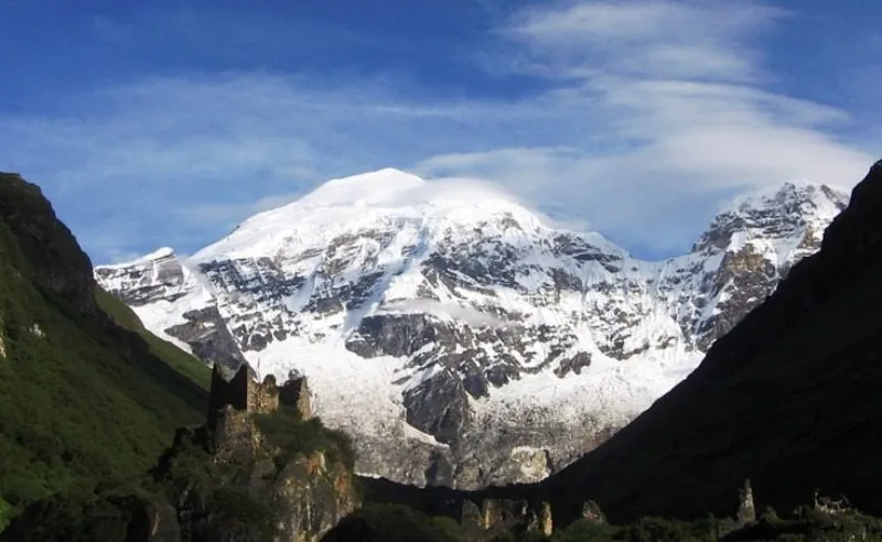
Day 4 breaks above the tree line entirely, crossing open yak pastures through the village of Soe before arriving at Jangothang (4,180 m), the base camp that sits directly below Jomolhari's north face. The mountain dominates the entire northern skyline from this camp, rising more than 2,700 meters above the valley floor to its summit at 7,326 m on the Bhutan-Tibet border.
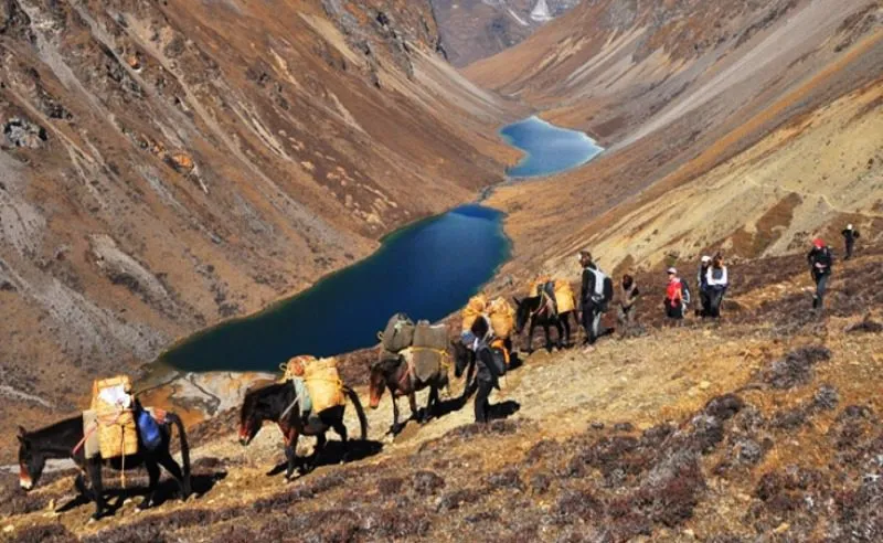
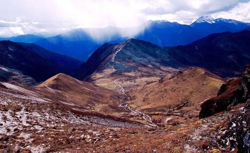
From Jangothang the route turns east and begins the loop section that distinguishes the Yaksa variant from the standard out-and-return Jomolhari trail. After a rest and acclimatization day, the trail climbs through steep rocky switchbacks past high-altitude lakes frequented by blue sheep before topping out at Bonte La (4,890 m), the highest point of the entire circuit. The pass sits on a broad, windswept ridge, with unobstructed views across the western Himalayan range into Tibet to the north and toward the Haa Valley ridgelines to the south.
The descent from Bonte La drops into the remote Soi Yaksa valley, a wide, sparsely populated highland corridor at 3,830 m, where the landscape opens into broad grazing terraces used by yak herders through the summer months.
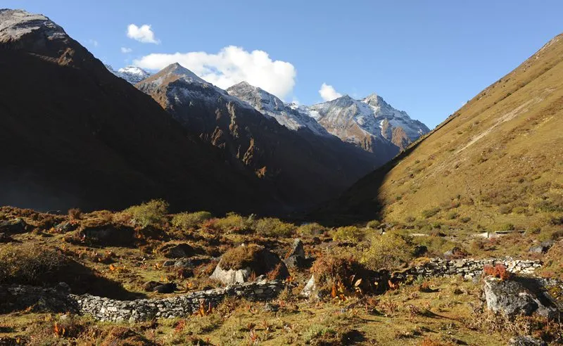
The following day crosses Thombu La at 4,380 m before dropping into the Thongbu Valley (4,120 m), a high grassland basin that serves as the final high camp before the long descent back to Shana begins.
The exit from the trekking circuit follows the same river corridor used on the approach, descending from Thongbu through temperate forest zones back to the Shana riverside camp at 2,950 m before a final short walk returns the group to the Drukgyal Dzong trailhead.
From here the cultural extension begins: the route moves east to Thimphu (2,350 m), Bhutan's capital, then crosses Dochula Pass (3,100 m) to the subtropical Punakha valley (1,310 m) before returning west to Paro for the final two nights.
The complete Jomolhari Yaksa Trek route is about 85 kilometers long and takes six active trekking days (Days 2–8, including the rest day at Jangothang), all within or next to Jigme Dorji National Park, and is a permitted trekking route according to the Tourism Council of Bhutan.
Best Season for Jomolhari Yaksa Trek
Spring (Late March to May)
Spring conditions bring the most visually distinctive flora on the lower trail sections: rhododendron forests along the Paro Chhu valley and the mixed broadleaf forests between Shana and Thangthangkha bloom from late March through April, and alpine wildflowers, including Bhutan's national flower, the blue poppy, appear on the high pastures from late April onward.
Daytime temperatures at village and camp altitudes between 2,950 m and 4,180 m range from 5 to 14 degrees Celsius in fair spring weather, with nights dropping to -5°C or below at altitudes above 3,800 m. The main risk in spring is late-season snowfall at Bonte La (4,890 m): the pass typically clears by mid-April in a normal year, but anomalous precipitation events can push the safe crossing window into early May. Spring trekkers should carry full cold-weather sleeping gear regardless of the departure date.
Autumn (Late September to November)
Autumn is the more consistently reliable season for high-altitude trekking across western Bhutan. The Indian monsoon retreats from the region by mid-September, and October in particular delivers the stable high-pressure systems and dry trail surfaces that make the Bonte La and Thombu La crossings most manageable. Visibility from the passes is sharpest in October and early November, with unobstructed sightlines toward the Tibetan plateau and the western Himalayan range under clear post-monsoon skies.
Daytime temperatures across the trekking section in October range from 8 to 16 degrees Celsius at camp altitude, with nights dropping to -5°C or below at altitudes above 4,000 meters. November remains viable and sees fewer trekking groups on trail, but early snowfall at the high passes becomes a real risk from mid-November onward and should be monitored closely in the weeks before departure.
Seasons to Avoid
The monsoon period from June through mid-September brings heavy precipitation, leeches on lower forest sections, and unstable trail conditions through the park; the route is not recommended during this window. December through February is cold and largely inaccessible above 4,000 meters without specialist equipment.
Who Is This Jomolhari Yaksa Trek For?
The Jomolhari Yaksa Trek is open to any adult traveler who arrives in good physical condition and carries realistic expectations about sustained high-altitude walking. There is no technical mountaineering component on this route, and no prior climbing experience is required. The primary demands are cardiovascular: daily stages range from 11 to 22 kilometers, daily elevation gain on the harder days reaches 900 meters, and the route spends three consecutive nights above 3,800 meters before the final descent.
Fitness and attitude matter more than age or background. Senior trekkers in excellent cardiovascular health have completed this route without difficulty, as have first-time Himalayan trekkers who prepared seriously over six to eight weeks before departure. The itinerary includes a rest and acclimatization day at Jangothang (4,180 m), which gives the body time to adjust before the two high passes on Days 6 and 7.
Medical Considerations
Travelers with cardiovascular conditions, uncontrolled hypertension, severe asthma, or a history of altitude-related illness should consult a physician before booking any itinerary that crosses above 4,000 meters. Pregnant travelers are advised against high-altitude trekking. Children aged 14 and above with an established trekking background may be considered for the lower sections of the route; the Bonte La crossing at 4,890 meters requires individual medical assessment before departure.
Jomolhari Yaksa Trek Difficulty
The trek is rated as moderate to moderately demanding. Daily stages cover 11 to 22 kilometers over five to seven hours of active walking. The longest day (Day 3) covers 22 kilometers over 7 to 8 hours. The hardest single section is the Bonte La crossing on Day 6: a steep, rocky switchback ascent of approximately 700 meters from camp to the pass at 4,890 meters, followed by a demanding descent on the Soi Yaksa side. No technical climbing is involved. Trekking poles are strongly recommended. Ankle-supporting waterproof trekking boots broken in before departure are essential.
Physical & Mental Preparation
Adequate preparation should start at least six to eight weeks before departure and include training for cardiovascular capacity, leg strength, altitude awareness, and psychological readiness for six consecutive nights in a tent at elevations between 2,950 and 4,180 meters.
Training Guidelines
- Begin structured cardiovascular training at least six weeks before departure: hiking, cycling, or running for 60 to 90 minutes, three to four times per week
- Incorporate weighted pack walks in the final four weeks, building toward five to six hours with a six-kilogram load on consecutive days
- Strengthen knees and ankles with step-downs, lunges, and single-leg balance exercises
- Practice early-morning departures; the Bonte La crossing day requires departure before 7:00 am from camp
- Acclimatise in Thimphu (2,350 m) and Paro (2,250 m) during the cultural extension days before the trek begins
- Consult a physician at least four weeks before departure regarding acetazolamide (Diamox)
- Avoid alcohol for the first two nights above 3,000 m, it accelerates dehydration and impairs acclimatization.
- Establish a daily hydration habit of two to three liters before the trek
- Inform the guide of any medical conditions, regular medications, or previous altitude-related symptoms before the first trekking day
Altitude Sickness & Prevention
Acute Mountain Sickness (AMS) is the most common medical concern on the Jomolhari Yaksa Trek and the primary reason some trekkers do not complete the Bonte La crossing at 4,890 meters. The guide team monitors all trekkers for AMS symptoms throughout the trekking section and is trained and authorized to start an immediate descent without waiting for client agreement if a situation worsens toward High-Altitude Pulmonary Edema (HAPE) or High-Altitude Cerebral Edema (HACE).
Symptoms — Report Immediately to the Guide
- Persistent headache unresponsive to paracetamol or ibuprofen after 30 minutes
- Nausea or vomiting, particularly when combined with headache
- Fatigue disproportionate to the day's exertion level
- Dizziness or loss of balance on flat ground
- Persistent dry cough above 3,800 meters
- Breathlessness at rest, distinct from breathlessness during active ascent
- Confusion, disorientation, or difficulty with simple tasks; these indicate HACE and require immediate descent
Prevention Measures
- Spend a minimum of two nights in Thimphu (2,350 m) before traveling to the trekking start point
- Ascend no more than 300 to 500 meters of sleeping altitude per day above 3,000 meters
- Maintain daily hydration of two to three liters on trail; monitor urine color as a hydration indicator
- Avoid alcohol, sleeping pills, and heavy exertion on the first night at each new altitude
- Eat small, frequent, high-carbohydrate meals; appetite suppression is common at altitude
- Carry and know how to use acetazolamide (Diamox) if prescribed by a physician
- Report any symptoms immediately to the guide; attempting to manage AMS symptoms without disclosure delays treatment and increases evacuation risk
Required Permits for Jomolhari Yaksa Trek
The Jomolhari Yaksa Trek sits within Jigme Dorji National Park and falls under Bhutan's standard high-altitude trekking permit framework. Tour in Bhutan arranges all permits on behalf of clients as part of the standard package. No permit can be applied for independently by travelers without a TCB-licensed operator's endorsement, and no permit can be obtained on arrival at the border or at the Gunitsawa army checkpoint.
Applications for permits must be submitted at least 30 days before departure; late applications may not be approved.
Permit Types
- Bhutan Tourist Visa: Issued by the Royal Government of Bhutan through the Tourism Council of Bhutan (TCB). The licensed tour operator must apply for the visa before arrival. It is not available on arrival at the border or airport.
- Sustainable Development Fee (SDF): USD 100 per person per night, applicable to all international tourists. Fixed at this rate until August 2027 under current TCB policy.
- Trekking Route Permit: Required for all organized trekking within Bhutan's protected areas. Arranged by the tour operator through the Tourism Council of Bhutan.
- Jigme Dorji National Park Entry Permit: A conservation levy is applicable for trekking within the national park boundaries. Arranged by the tour operator in coordination with the Department of Forests and Park Services.
- Army Checkpoint Compliance: The Gunitsawa checkpoint at the start of the trail requires permit documentation for all trekking groups. The guide manages this process; all participants must carry their passport on the first trekking day.
Accommodation & Meals
Hotels (Cultural Extension Days)
Pre- and post-trek nights in Paro, Thimphu, and Punakha are in licensed 3-star hotels with private en-suite bathrooms, consistent hot water, Wi-Fi, and included breakfast. Travelers requesting 4-star or 5-star property upgrades can arrange these through Tour in Bhutan, with the additional cost confirmed at the time of booking.
Camping (Trekking Days)
On the active trekking section (Days 2–8), the tour in Bhutan porter and kitchen crew erect and manage all camping tents. There are no teahouses, lodges, or fixed guesthouses on the trail between Shana and the trailhead exit. The tour in Bhutan provides sleeping bags rated to -10°C; trekkers bringing personal bags should confirm the temperature rating before departure.
Meals
Three meals per day are provided on all active trekking days, prepared by a dedicated trail cook. Morning meals include porridge, eggs, buckwheat pancakes, toast, and hot beverages. Trail lunches feature rice, lentil dishes, and seasonal vegetables. Evening meals include grain, ema datshi, vegetable curry, or noodle dishes, with soup and dessert on most nights.
Dietary requirements, including vegetarian, vegan, and gluten-free, are accommodated with a minimum of four weeks' advance notice. Purified water is prepared and distributed by the kitchen crew at each campsite.
Gear & Equipment Checklist
Trekking Clothing & Footwear
- Waterproof, ankle-supporting trekking boots, fully broken in before departure — no new boots on the trail
- Moisture-wicking base layer top and bottom (two sets minimum)
- Insulating mid-layer: fleece or down jacket rated to at least -10°C
- Waterproof, windproof hard-shell jacket and matching waterproof trousers
- Warm hat covering ears and a sun hat or peaked cap
- Balaclava or neck gaiter for the Bonte La crossing day
- Lightweight liner gloves and insulated waterproof outer gloves
- Merino wool or synthetic trekking socks (four to six pairs) and gaiters for muddy lower sections
- Trekking sandals or lightweight camp shoes for evenings at camp
Trekking Equipment
- Telescopic trekking poles with wrist straps, essential for Bonte La ascent and descent
- Daypack of 25 to 35 litres for daily carry
- Duffel bag of 60 to 80 litres for porter carry (provided by Tour in Bhutan if required)
- Headlamp with spare batteries or USB-rechargeable model
- Sleeping bag rated to -10°C (provided by Tour in Bhutan; personal bag acceptable if temperature-rated)
- High-quality sunglasses with UV protection
- Dry bags or heavy-duty waterproof bags for protecting kit inside the daypack
- Personal reusable water bottle (minimum 1 litre; 2-litre capacity recommended)
- Power bank (10,000 mAh minimum); electricity is unavailable on the trekking section
Health & Medical Kit
- Personal prescription medications in original packaging with five additional days of supply
- Acetazolamide (Diamox) if prescribed by a physician before departure
- Ibuprofen and paracetamol for pain and headache management
- Oral rehydration salts (at least six sachets)
- Blister care kit: moleskin, sports tape, antiseptic, sterile needle
- High-SPF sunscreen (SPF 50+) and UV-protective lip balm
- Water purification tablets or personal filter as backup
- Anti-diarrhoeal medication and antihistamine
- Personal first aid: bandages, wound closure strips, antiseptic wipes, sterile dressings
Documents & Essentials
- Passport valid at least six months beyond the return date, with visa documentation
- Insurance policy documentation with emergency assistance number highlighted
- Physical and digital copies of all permits
- Emergency contact list and next-of-kin details provided to the tour in Bhutan before departure
- USD cash in small denominations; card payment is not available on the trail
- Camera equipment and spare batteries (cold temperatures reduce battery life significantly above 4,000 m)
Travel Insurance
Travel insurance is compulsory for all participants of the Jomolhari Yaksa Trek and should be confirmed in writing with Tour in Bhutan prior to the first trekking day. Given the route's maximum altitude of 4,890 meters, the six-day remote trekking section inside Jigme Dorji National Park, and the limited medical infrastructure above the valley floor, the policy must specifically cover the following:
- Helicopter emergency medical evacuation
- High-altitude trekking to at least 5,500 meters
- Trip cancellation or curtailment due to medical grounds
Standard travel policies purchased through airline booking platforms or credit card providers frequently exclude high-altitude trekking and do not cover helicopter evacuation. Trekkers should obtain specialist adventure travel insurance from a provider that explicitly lists high-altitude Himalayan trekking as a covered activity.
Tours in Bhutan must receive the policy documentation, including the policy number, provider contact details, and emergency assistance phone number, before the trek departure date.
Emergency & Medical Evacuation
Our team maintains an emergency response protocol for all trekking groups. The guide team carries a satellite communication device throughout the trekking section, providing contact with the Tour in Bhutan operations center in Thimphu regardless of mobile network availability, which is absent for the majority of the route.
If a medical emergency occurs that requires an evacuation, the guide contacts the operations center, which simultaneously organizes helicopter landing zones, dispatch of emergency medical personnel, and insurer notification. Helicopter evacuation from the Jomolhari trail corridor is operationally feasible in suitable weather, using clearing zones in the Jangothang valley and open pasture sites above Shana. In poor weather, helicopters may not be able to access the site for 12 to 48 hours.
The nearest hospital with surgical capacity is in Thimphu, while Paro District Hospital can provide emergency stabilization but has limited specialist capacity.
Guide & Porter Team
A licensed Bhutanese trekking guide holding current Tourism Council of Bhutan certification accompanies every Jomolhari Yaksa Trek group. For groups of five or more trekkers, a separate assistant guide joins the team. The guide's decisions regarding pace, departure time, and descent protocols on the Bonte La crossing day are non-negotiable on safety grounds.
Porters and horsemen carry all camping equipment, kitchen supplies, and client duffel bags, with individual loads managed under Bhutan's porter welfare guidelines. Porters are hired locally from the Paro District where availability permits.
Important Notes
- Permits must be applied for at least 30 days before departure; late applications risk non-approval
- No mobile network exists on the trekking section; the guide's satellite device covers emergencies only
- Bonte La crossing departs no later than 7:00 am; afternoon conditions at 4,890 m deteriorate rapidly
- Single-use plastic bottles are prohibited in Jigme Dorji National Park; carry a reusable bottle throughout
- Photography of individuals and communities requires explicit permission each time; declined requests are final
- Disclose any AMS symptoms to the guide immediately; the guide's descent decision is non-negotiable
- Carry sufficient Ngultrum or Indian rupees before the trek; no banking facilities exist on the trail
- Smoking is strictly prohibited at campsites, on trails, and within Jigme Dorji National Park boundaries
- All waste is managed under Leave No Trace principles; nothing is left at any campsite
- The minimum booking is two persons; solo travelers join group departures or book private with a single supplement
- Break in trekking boots fully before departure; new boots on the 22-kilometer Day 3 section cause injury
Book Your Jomolhari Yaksa Trek Expedition
The Jomolhari Yaksa Trek is widely regarded as one of the world's most demanding and rewarding Himalayan trekking adventures. Because the route passes through remote, restricted regions with a short trekking season, limited permits, and complex expedition logistics, careful planning is essential for a safe and successful journey.
Whether you're planning a private expedition with friends, seeking a personal mountaineering challenge, or fulfilling a lifelong dream of trekking through Bhutan's untouched northern Himalayas, our experienced Bhutan trekking team will design an itinerary tailored to your goals, experience level, and schedule.
Ready to Take on the Jomolhari Yaksa Trek?
Contact our Bhutan trekking specialists to:
- Check available trekking dates and seasonal availability
- Discuss your trekking experience and fitness level
- Receive a customized Trek itinerary
- Get a detailed, personalized cost quotation
- Learn about permits, logistics, equipment, and preparation
- Ask any questions about planning your expedition
Every Jomolhari Yaksa Trek is carefully planned to provide a safe, well-supported, and unforgettable experience in one of the world's last great wilderness trekking destinations.
Start planning your Jomolhari Yaksa Trek today.