
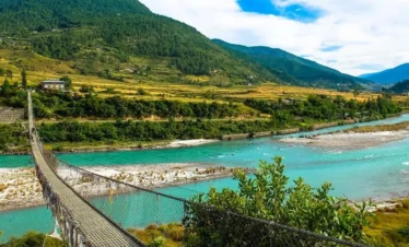
Bhutan’s Snowman Trek is one of the most remote long-distance treks in the world. This 23-day private expedition crosses 11 high-altitude passes through the restricted northern highlands, moving from Thimphu through the Gasa district and deep into the Lunana region before finishing in Paro with a hike to Tiger’s Nest.
Tour in Bhutan has been operating in Bhutan since 2008, and our Managing Director, Bharat Sapkota, has walked the Snowman route himself. TCB-licensed Bhutanese specialists guide every departure and fully support it from the first permit to the final camp. Read more about us or see what our travelers say on TripAdvisor, where we holds a 4.9 rating based on 174 reviews.
-
5,005m/16,420ft
-
March to May and September to November
-
Full board (breakfast, lunch and dinner)
-
Government approved 3 stars and Above
-
Private car, van or bus (Depends on group size)
-
Private Tour
Key Highlights of Bhutan Snowman Trek
- Cross 11 high-altitude passes, several exceeding 5,000 meters, through Bhutan’s restricted northern highlands
- Spend time in Laya, one of Bhutan’s most isolated communities, at 3,800 meters
- Trek deep into the Lunana region, accessible to fewer than 200 trekkers per year
- Camp beside Thampe Tsho, a glacial lake set in high alpine terrain above 4,000 meters
- Walk through protected wilderness covering black-necked crane habitat, blue sheep territory, and old-growth conifer forest
- Complete the route with a hike to Taktsang Palphug Monastery, Tiger’s Nest, at 3,120 meters above Paro Valley
- Travel entirely privately with a TCB-licensed guide, dedicated kitchen crew, and full camping support
- Experience Bhutan’s High Value Low Volume tourism model in a country that limits arrivals by policy to protect exactly this kind of landscape
Overview of Snowman Trek
The Snowman Trek is widely regarded as one of the hardest and most rewarding long-distance treks on Earth.
Recognized by the Tourism Council of Bhutan as the country’s longest trekking trail, the route traverses the northern frontier of the kingdom along the Tibetan border, rising to a highest point of 5,230 meters at the Gophu La pass and dropping as low as 2,850 meters at Sephu.
It was created by the yak herders of Bhutan’s high valleys and passes through terrain so isolated that fewer than 200 trekkers complete the full route in any given year.
Since records began in 1982, the total number of full completions stands at roughly 500, which is fewer than the number of people who have orbited the Earth.
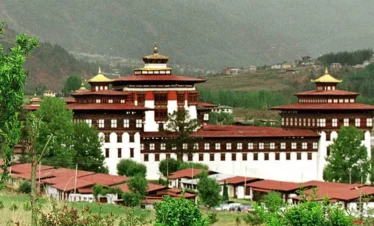
The route begins with acclimatization days in Thimphu and Punakha before the trek itself starts at Tashithang.
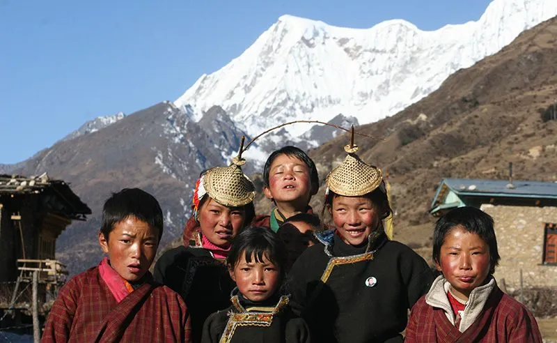
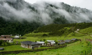
From there it climbs steadily through the Gasa district, reaching Laya at 3,800 meters on roughly Day 6, one of Bhutan’s most isolated communities, where women wear distinctive conical bamboo hats found nowhere else in the country and yak herding remains the primary livelihood.
Laya sits within the protected boundaries of Jigme Dorji National Park, Bhutan’s largest national park, which covers the entire northern trekking corridor.
After a rest day at Laya, the route pushes north across Gangla Karchung La into Lunana, a region so remote that the Bhutanese government restricts access through a mandatory special inner-line permit
No independent trekking is permitted anywhere in Bhutan; all travel must be arranged through a licensed operator registered with the Tourism Council of Bhutan.
Thanza, the largest village in Lunana, sits at 4,000 meters and holds fewer than 200 permanent residents. It is reachable only on foot.
A rest day here is built into the itinerary before the trek enters its hardest and most consequential section.
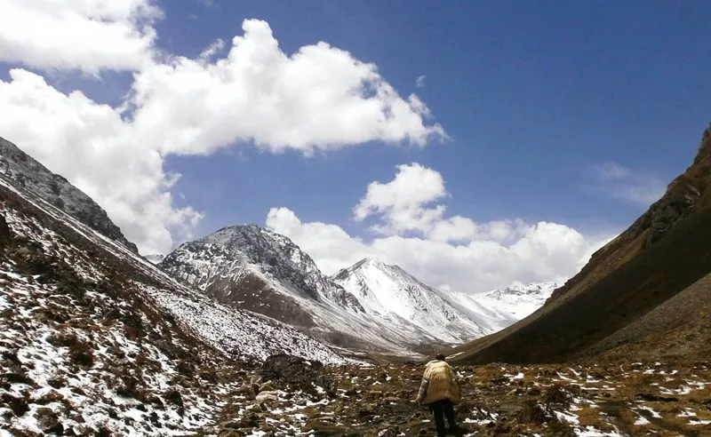
Passes between Thanza and the southern exit cross above 4,900 meters on consecutive days at Tshochena, Jichu Dramo, and Chukarpo, among the highest camp elevations on the entire route.
The route crosses five passes above 5,000 meters in total. Weather windows on these high crossings are narrow, and the physical demands compound daily.
Most failed attempts on the Snowman Trek turn back in this section.
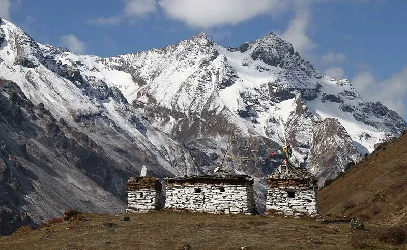
Trekkers who push through emerge at Thampe Tsho, a glacial lake at high altitude, before the long descent through Maurothang and Sephu back to the Bhutanese road network.
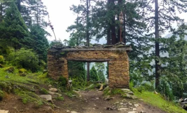
Throughout the crossing, the landscape shifts between glacial valleys, high-altitude tundra, rhododendron forest, and yak pastures.
The route overlooks some of Bhutan’s most celebrated peaks: Jomolhari at 7,326 meters, Jichu Drake at 6,662 meters, Masangang at 7,194 meters, and Gangkar Puensum, the highest unclimbed mountain on Earth.
Snow leopards are recorded in this corridor. Black-necked cranes, a protected species, winter in the lower Lunana valleys from late October onward.
Recently, breeding pairs have also been recorded at higher elevations within the Lunana region.
Bhutan is the only carbon-negative country in the world, constitutionally mandated to maintain a minimum of 60% forest coverage; it currently holds 72%.
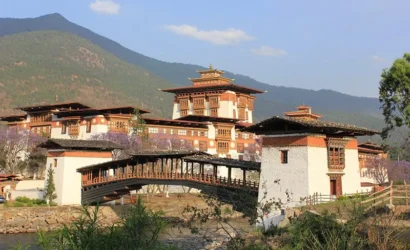
The trek closes with a cultural return through Punakha and Thimphu and a final night in Paro, concluding with the Tiger’s Nest hike, a single itinerary that moves from the most remote corner of the kingdom to its most iconic site.
We have guided this route repeatedly and manage every logistical detail: permits, camping, kitchen crew, and evacuation protocols.

Write a Review